
 August 17, 2013

A trio of Hibiscus Flowers in near-perfect bloom
After having sampled every culinary treat I could find in Naha, and subsequently lounging off the post-meal malaise on the beaches of Zamami-jima, my next destination was that of the Yaeyama Islands in the very Southwest corner of the Okinawan Island chain (only a stone’s throw away from Taiwan, if that gives you a better idea of location). Continuing with the trend of pushing farther and farther away from the mainland of Japan, the Yaeyama Island’s are even more geographically isolated, the climate is hot and humid enough to sustain some of the country’s only sub-tropical jungles and mangrove swamps, and the idea of modern development that we usually associate with Japan is something better left to those mainlanders to the far North. As such, these largely untouched islands offer a haven for outdoor enthusiasts, with a variety of amazing trekking, hiking, kayaking, and exploration activities — not to mention diving and snorkeling, but, for me at least, that will have to wait for another trip.
Ishigaki Island:
The main port of entry for most visitors to the Yaeyama Islands is through Ishigaki City, located to the Southwest side of Ishigaki Island. Although this does qualify as the most developed section of the surrounding area, the city itself is still quite small, acting primarily as a jumping off point for other activities in the area. And although the bus system here is a bit difficult to navigate for a non-Japanese speaker such as myself (there is significantly less English here than other parts of Japan, where there is already very little), I did manage to somehow get myself around to the island to check out a few of the sights:
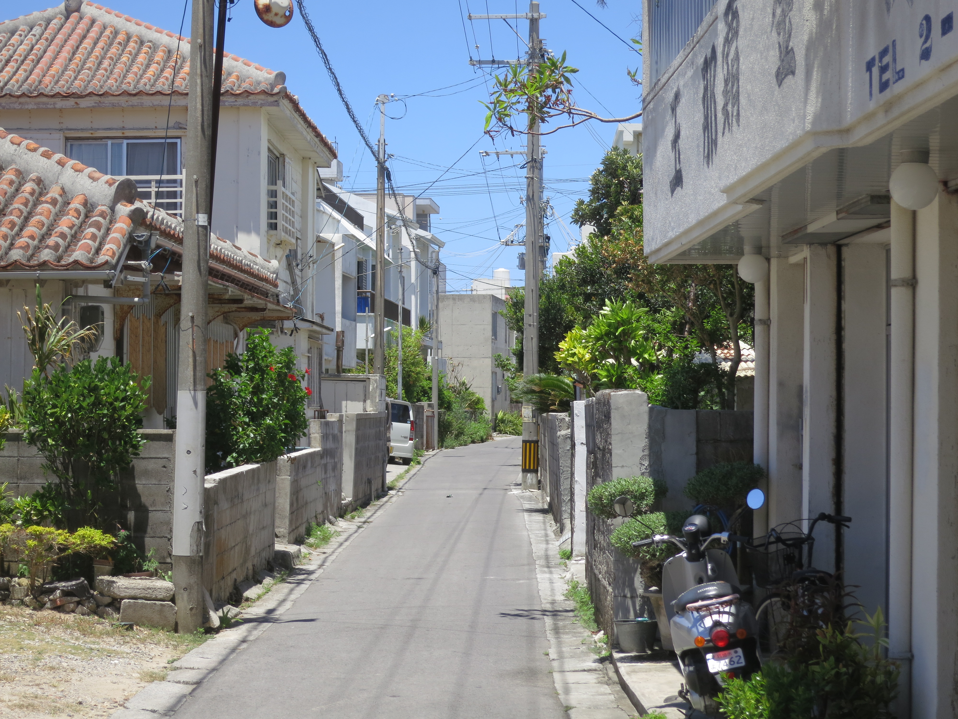
The streets of Ishigaki City – this is just about as lively as it gets
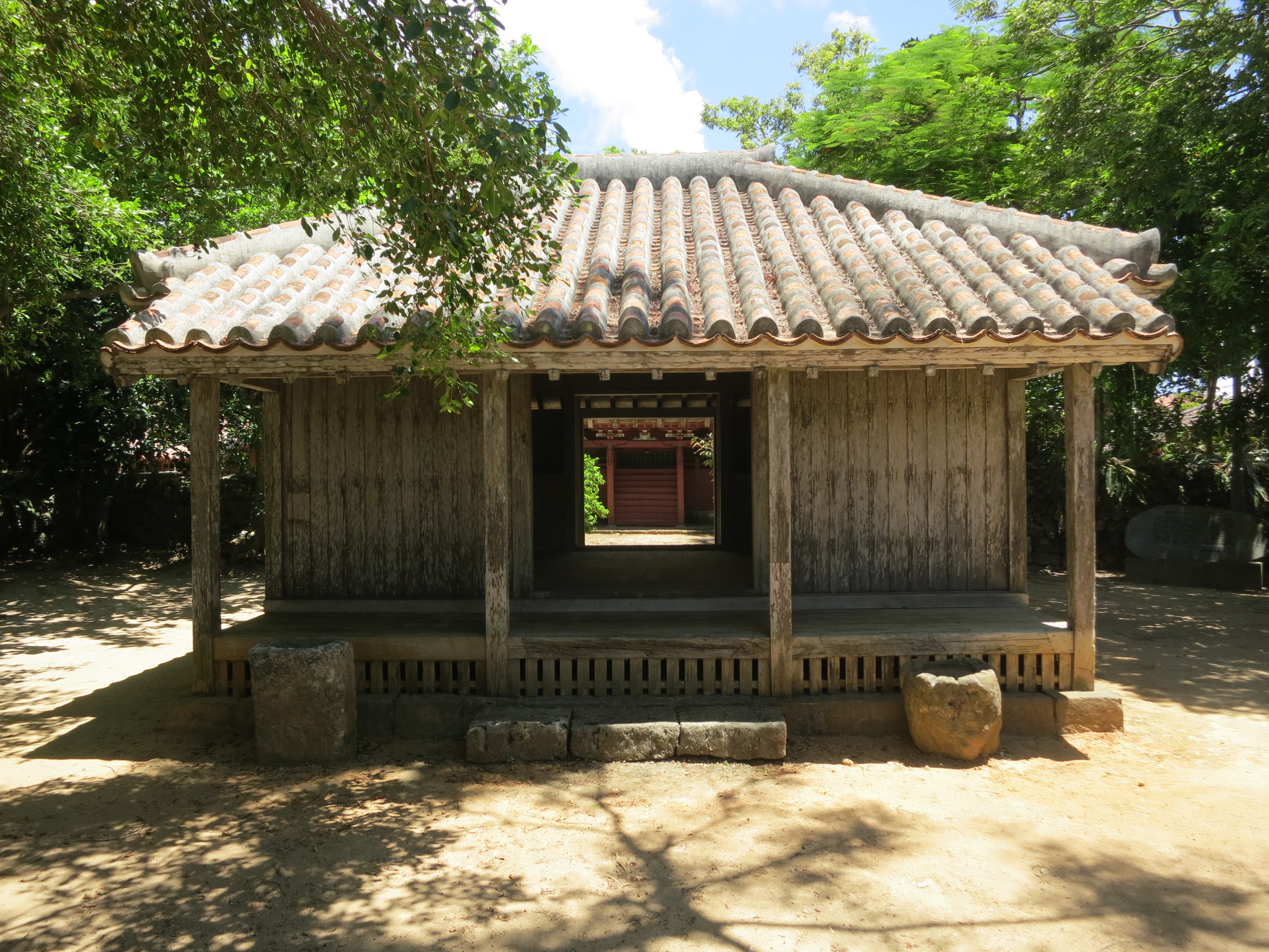
Even the shrines take on a more laid-back, rural feel (pictured here is Gogendo Shrine, just outside the city center)

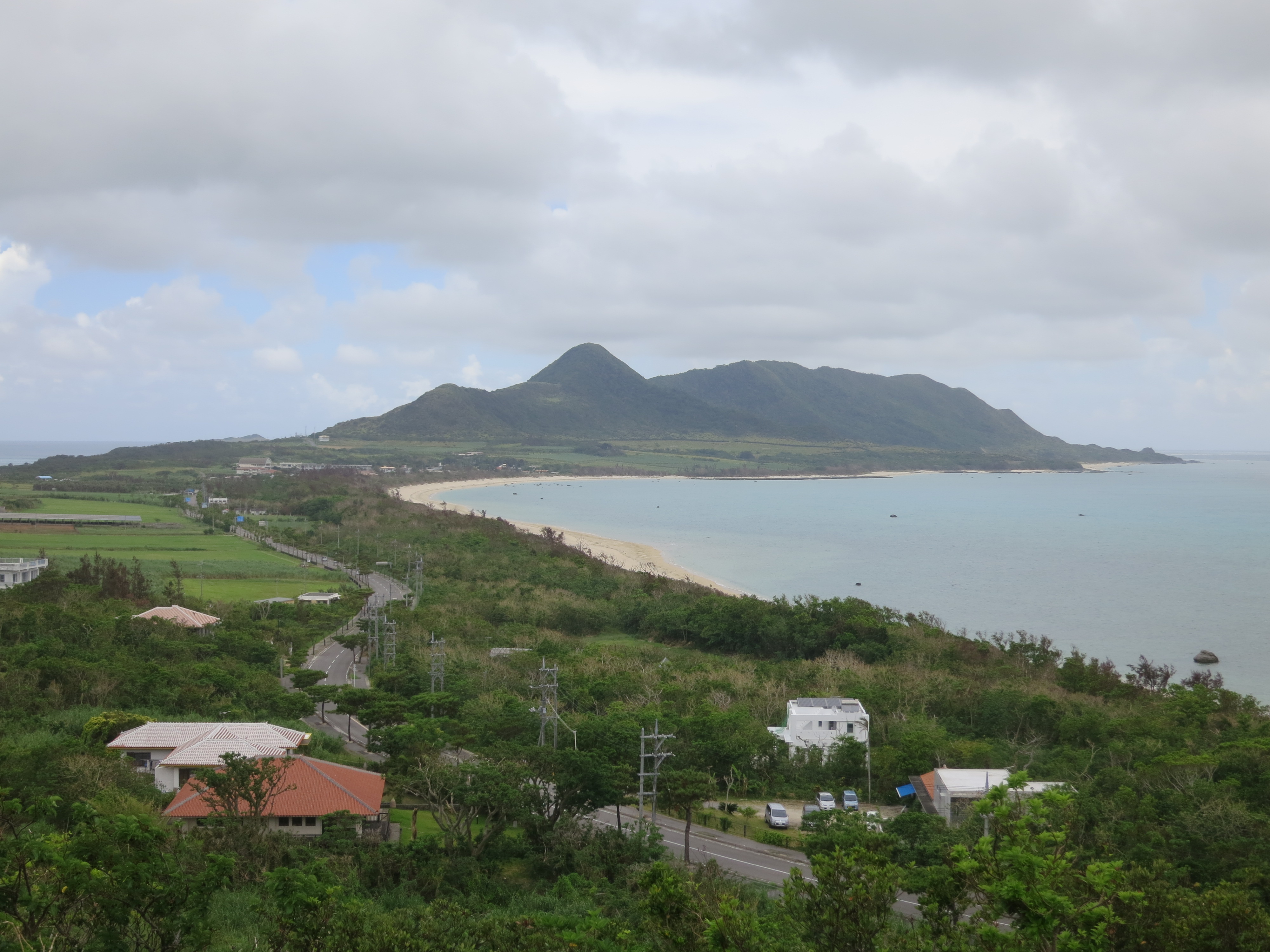
The view of Ishigaki Island from the Tamatorizaki Viewing Platform

Looking up from within the Yonehara Palm Tree Grove

When out of sight of the blue of the ocean, the most dominate color you’ll find on the island easily becomes a vivid green

Toujing Tomb, a site dedicated to a group of Chinese laborers sailing from California whose ship crashed ashore on the Island of Ishigaki
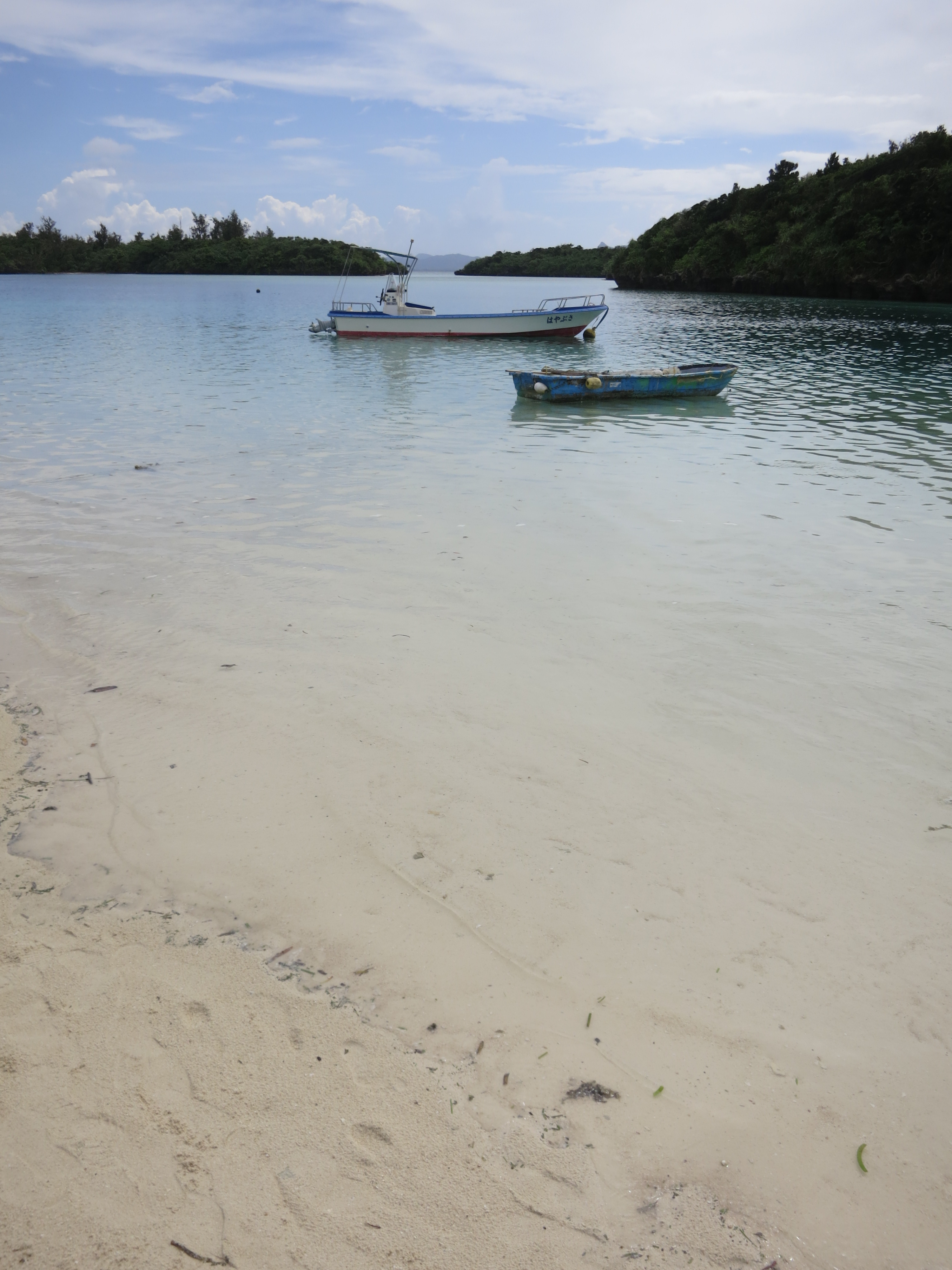
The highlight for most visitors to Ishigaki Island is that of the famous Kabira Bay, a open stretch of turquoise water hemmed in on three sides by the hilly jungles of the area, that is then dotted with a variety of tiny, forested islands, making for a beautiful vista from any angle. Unfortunately, this is also the most popular spot on the entire island for visiting tourists, meaning that you’ll have to fight your way through the crowds and dodge the ever present “glass bottom boat” touts. The sheer beauty of the surrounding environment makes it all worth while, however:
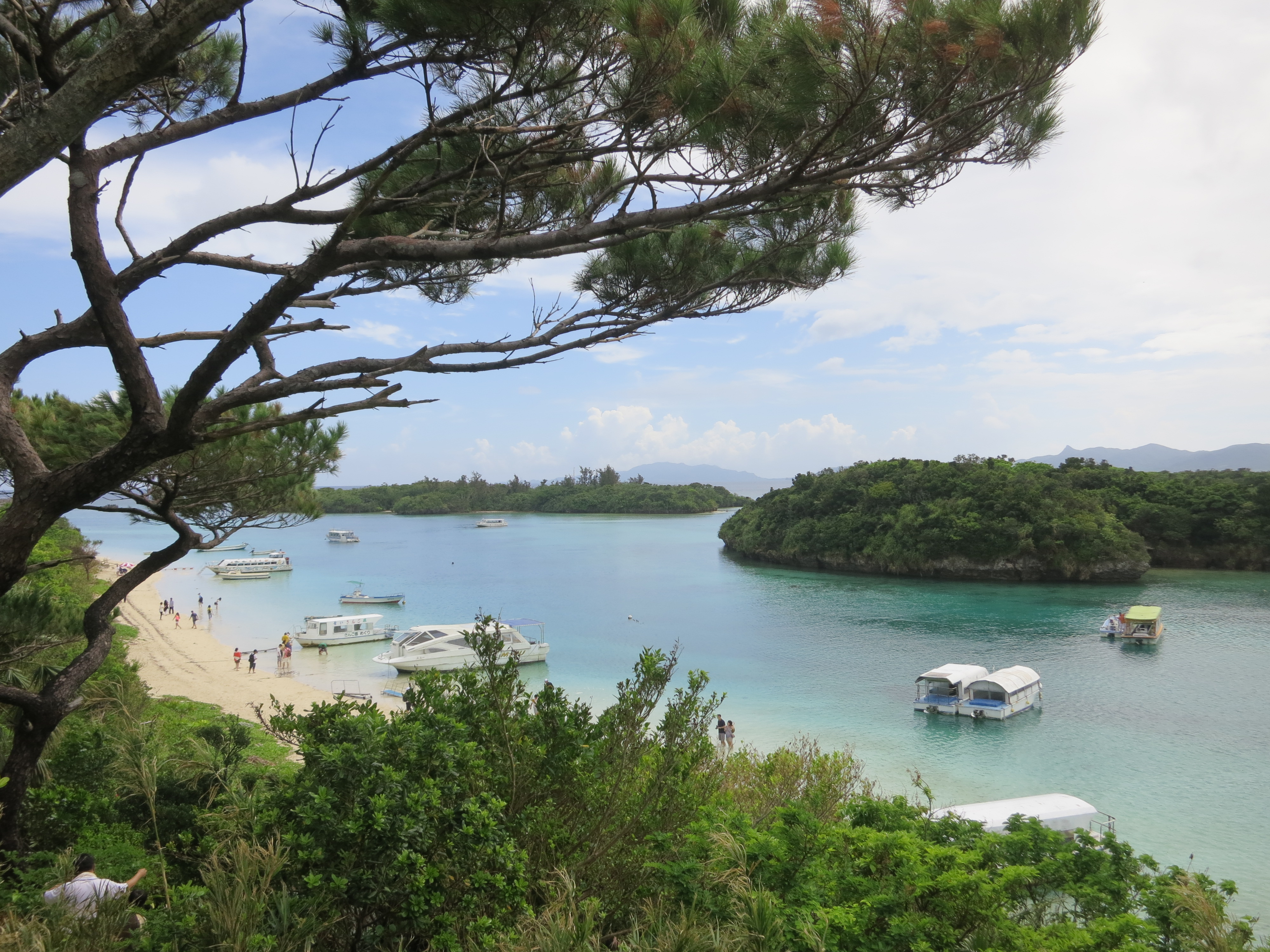
The postcard-worthy view that is Kabira Bay

The path down to the beach

Another slice of paradise

A look at just how crystal clear the waters are here

Crowds mingling around the beach area

A small but endearing shrine near the entrance to the bay
Iriomote Island:
Only an hour’s ferry ride from Ishigaki Island lies the poster child for the untamed Yaeyama Islands: that of Iriomote Island. With nothing more than a few business clustered around the ferry port and a variety of outdoor outfitters, the island — the primary home to the subtropical jungles and mangrove forests mentioned above — offers up some of the best opportunities to get away from civilization and explore the natural environment. And if trekking through an uncharted island sounds a bit intimidating for some, there are also a variety of easier, less-taxing river cruises and leisurely hikes perfect for day-trippers coming from Ishigaki. Regardless of your choice of activities, almost every visitor begins by juming on a boat from the ferry port and heading up the mouth of Urauchi River for a look at what lies within:
Heading into the interior of the island

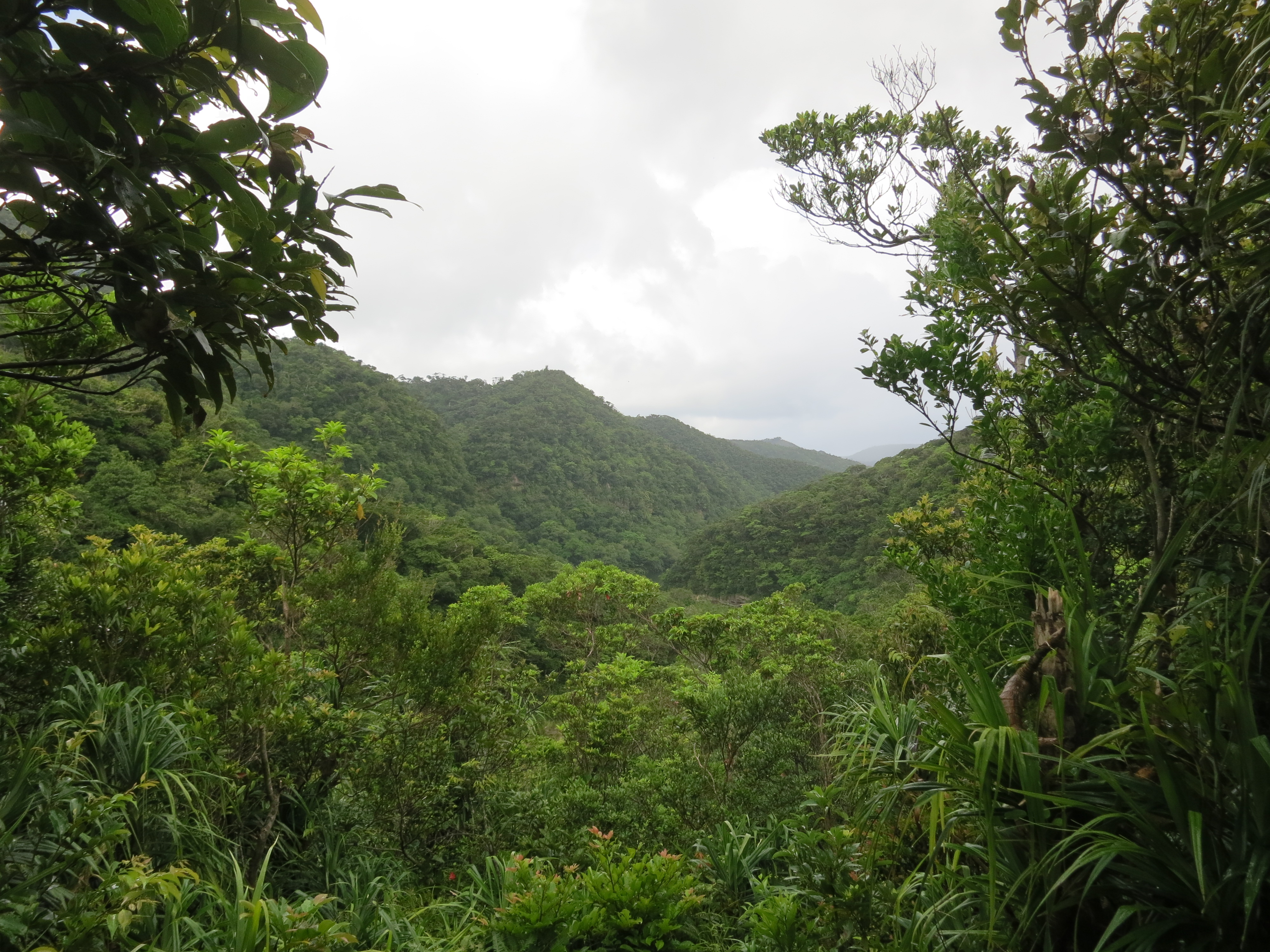
A look at the indigenous vegetation that seems to consumesevery bit of land right up to the river

After a scenic 40-minute boat ride, riders can then disembark and opt for a relatively easy 2-hour hike that leads to a pair of scenic waterfalls amidst the hills and mountains within:

The foliage along the trail looks quite a bit different than my last hike a few weeks back along the Kumano Kodo

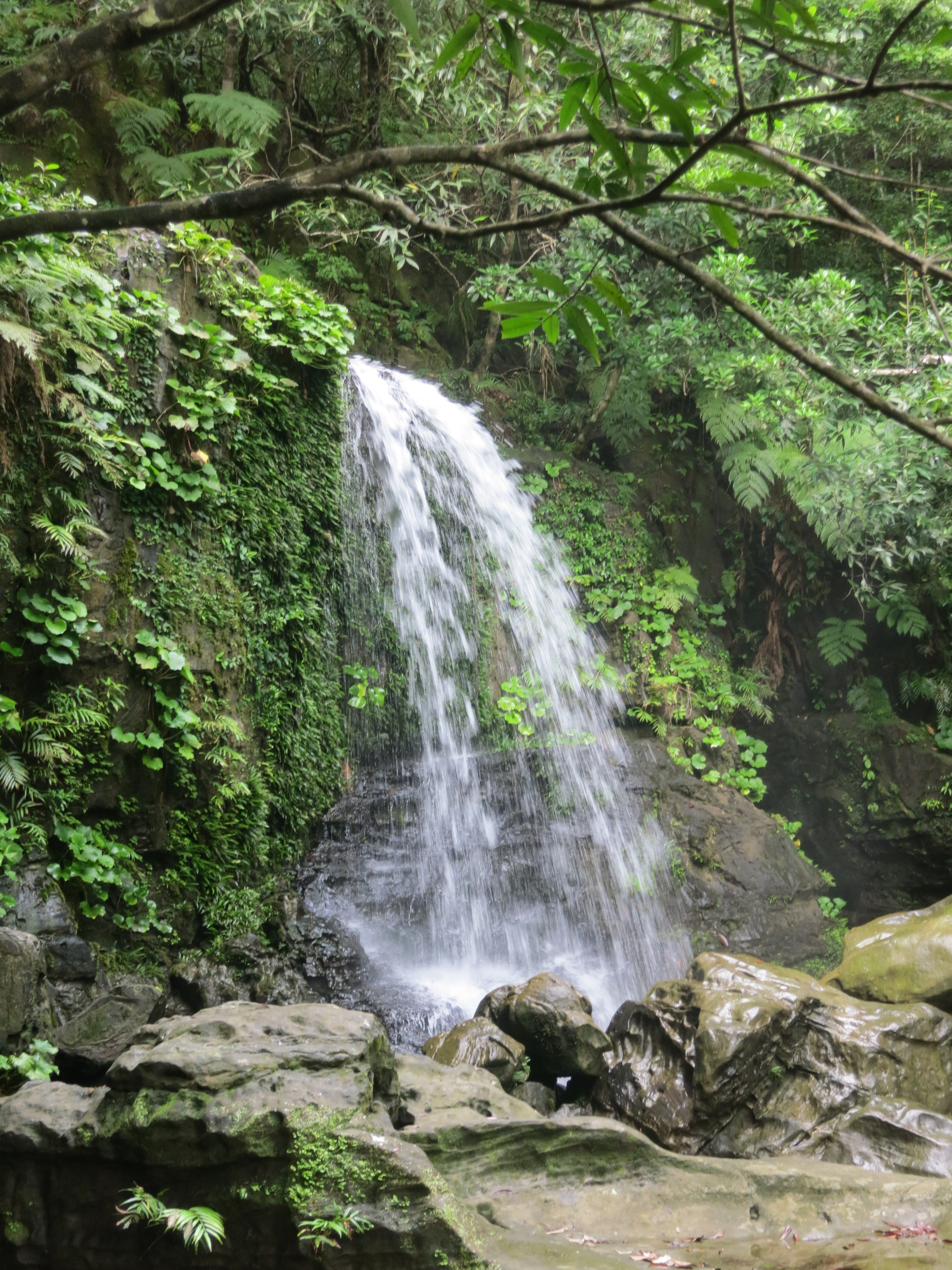
The Mariyudu Waterfalls first coming into view


Kanbira Falls, just up river from the Mariyudu falls seen above

The flow of the river has created an almost alien landscape around the Kanbira Falls, one that visitors are welcome to climb around on and explore
Back into the jungle…

…but not before a quick Bento lunch to keep the energy level high
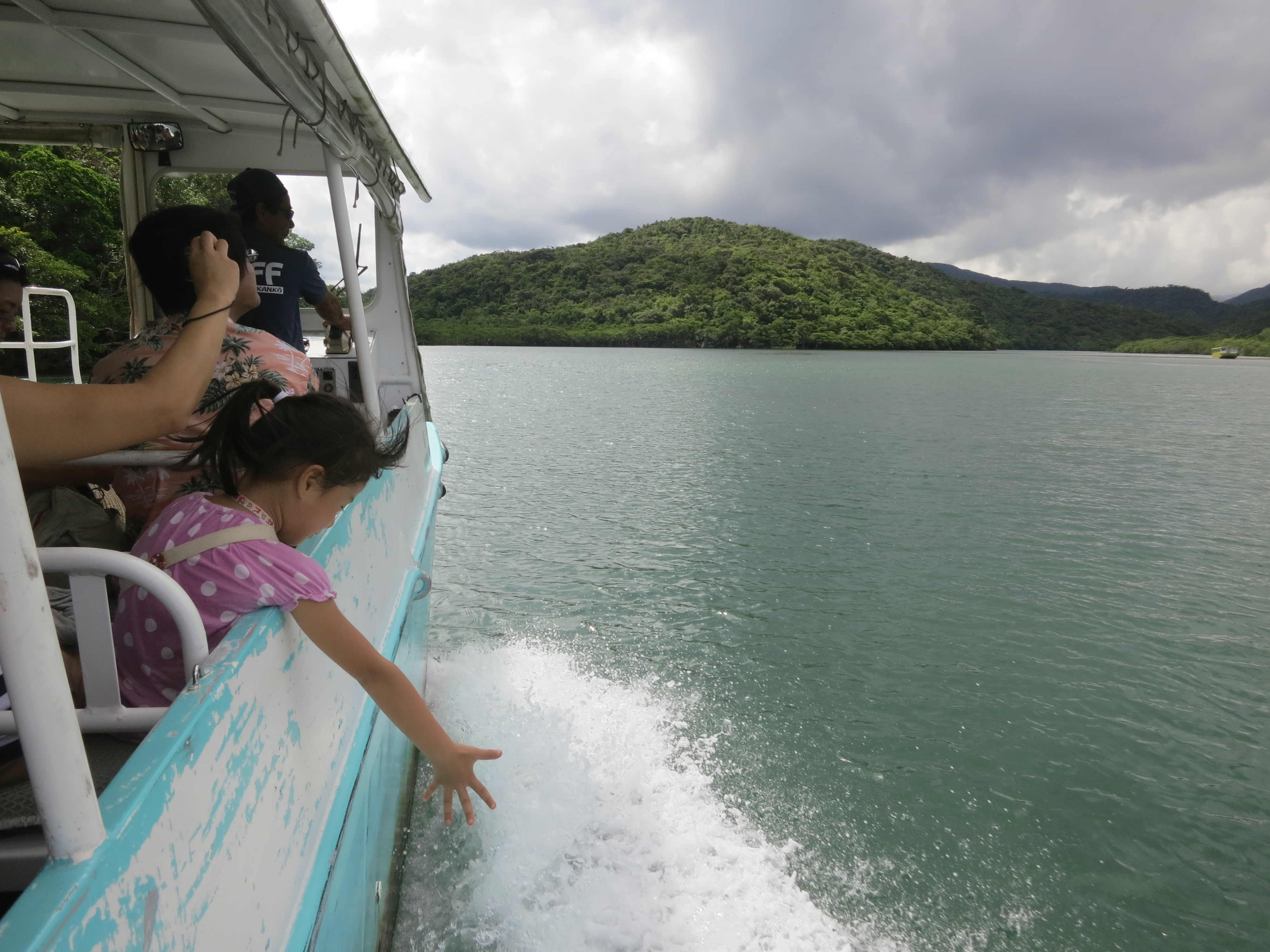
As opposed to simply catching the boat back to the ferry port, I opted to go the extra mile, be the outdoors-y explorer that I am, and rented a kayak to get a better look at the island’s rivers and tributaries. After all, it isn’t really “exploring” unless you work up a bit of a sweat:

Getting out on the river itself was a thoroughly rewarding experience

One of many private and secluded beaches just waiting for someone to stake their claim

Getting a closer look at the mangroves swamps
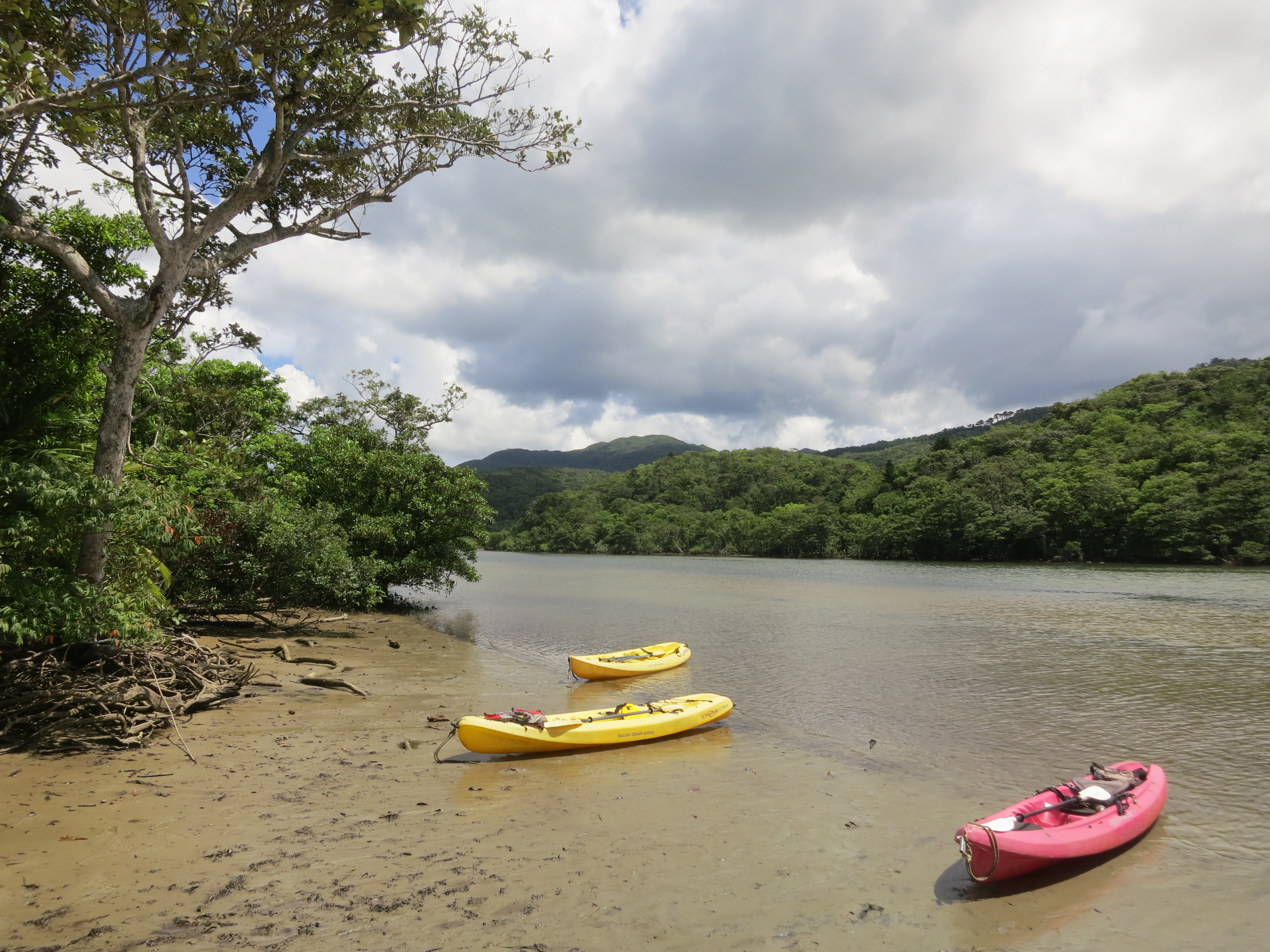

The kayaks allowed us to explore some of the smaller rivers and streams that the normal ferry boats can’t reach
One such side trip took us to a beautiful waterfall the was hidden away down a small tributary

Unbeknownst to me at the time (seeing as I don’t speak Japanese and the guide didn’t speak English), our path actually took us through the afore-mentioned waterfall. And chalking it up to the “Learn something new every day” adage, I have now learned that my camera can take a direct hit from a waterfall. Who knew?

Even though I’ve already posted my culinary adventure through Okinawan cuisine, I did manage to find a few additional treats here on Ishigaki and Iriomote Islands that are more specific to the Yaeyama Islands themselves. After all, who doesn’t enjoy a few extra food pictures?
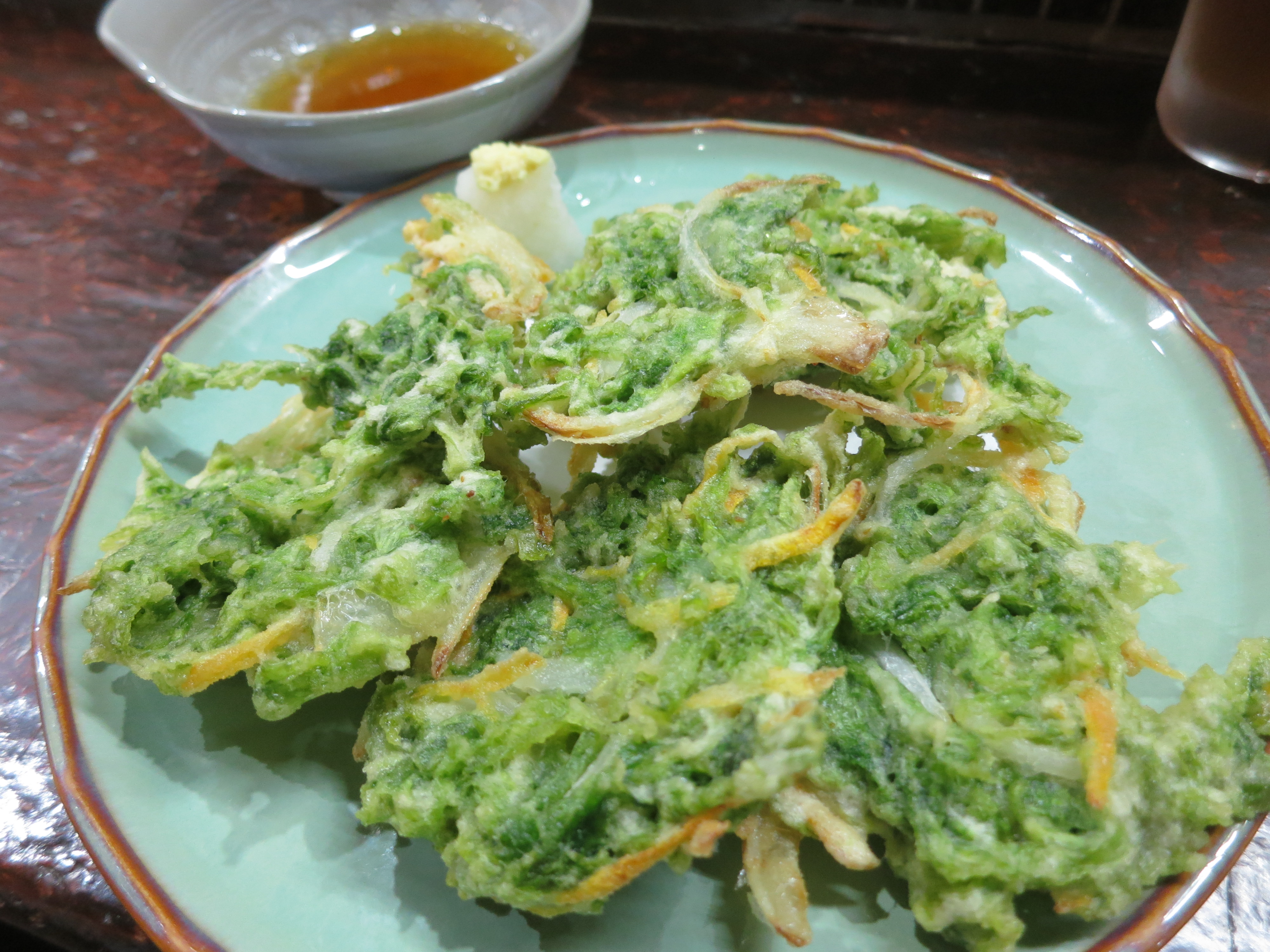
A type of local seaweed that is cooked up tempura-style and dipped in ponzu sauce
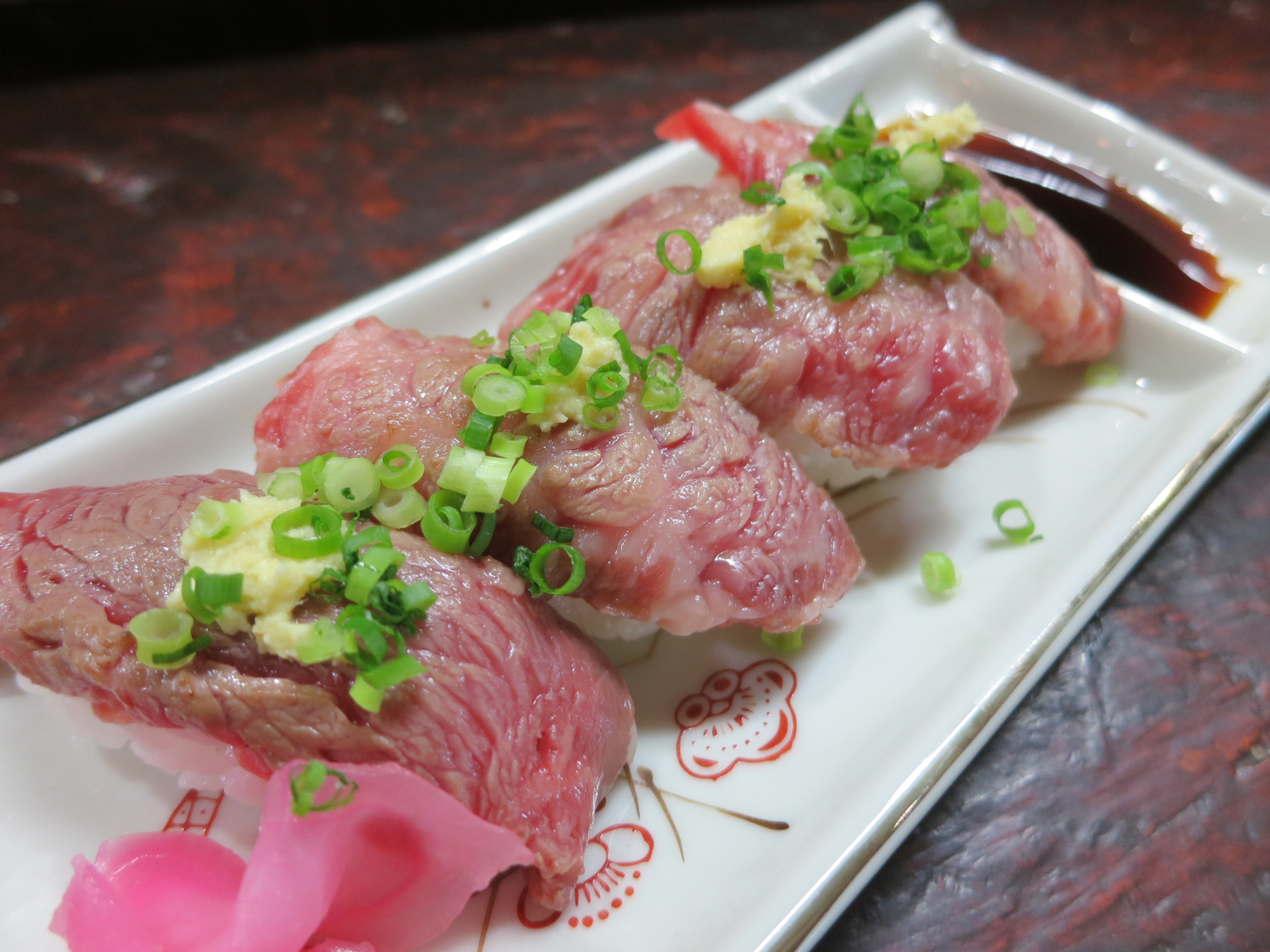
Ishigaki Island, specifically, boasts of its own variety of premium beef. As such, I opted for a bit of Beef Sashimi, which was delicious, albeit a bit chewy due to the raw nature of the meat

A local river fish called Guruken that is fried and eaten whole (bones, head, and all)

Although it is found all over Okinawa, Soki Soba still makes for the perfect lunch or midday snack
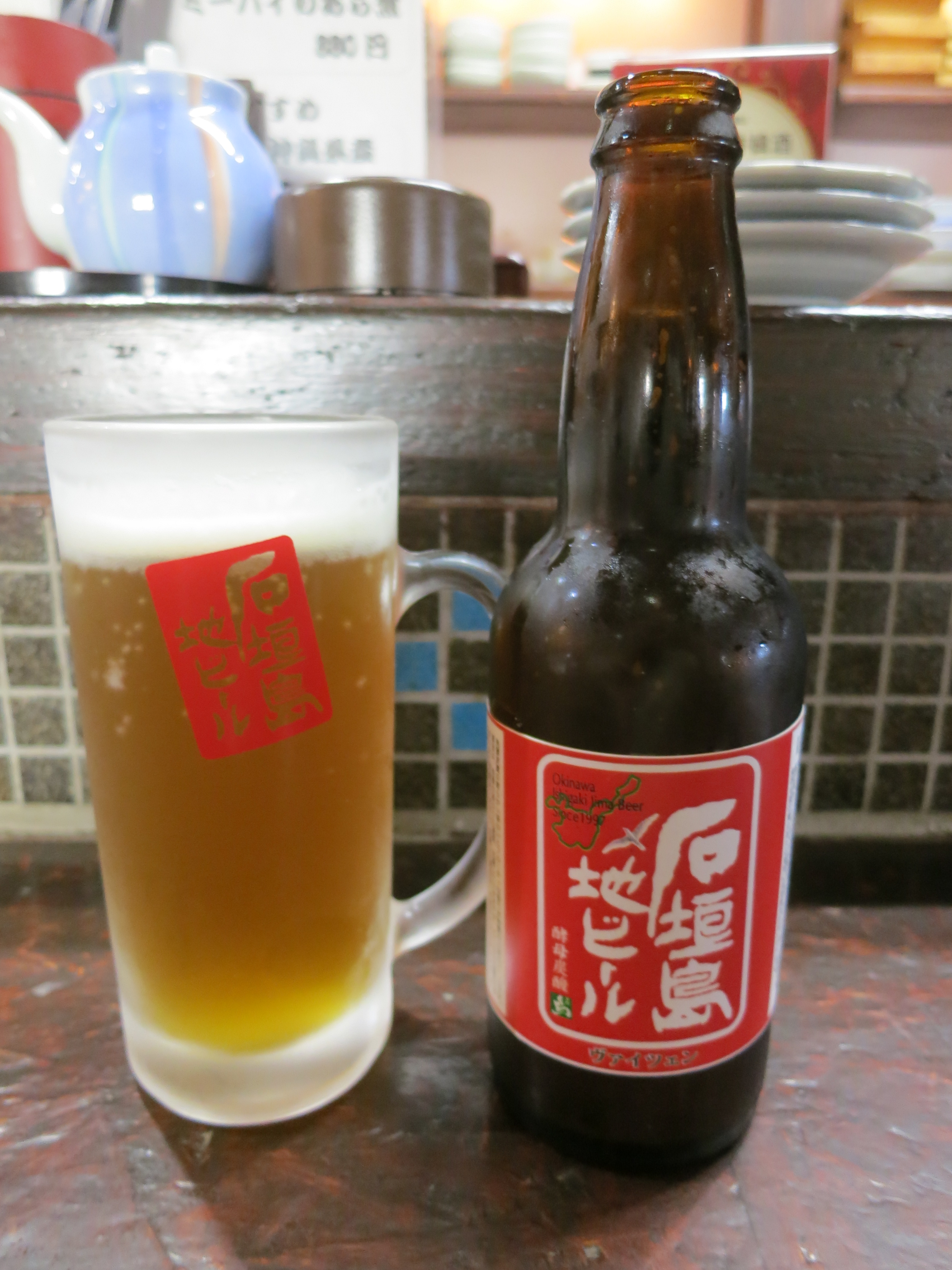
To both my astonishment and delight, there is actually a micro-brewery on Ishigaki Island, meaning I didn’t have to deprive myself of good beer on this part of my voyage

Given the immediate proximity to Taiwan, I couldn’t resist indulging in a Taiwanese Mango Ice Mountain in an attempt to beat the heat
I’m sad to say that the Yaeyama Islands mark the end of my time in Japan, a country of which I will seemingly never grow tired. But moving forward, my next destination is one I’ve longed to visit ever since I first was bitten by the travel bug: that of Myanmar (or Burma, if you prefer). And being that this is my “Last Hurrah” voyage, Myanmar will also mark the last “new country” for me on this particular Round-the-World trip, so it will inevitably be a bittersweet introduction to a new culture for me. So with that, I’ll adjourn my posts from Japan, will prepare for my 36-hour, 6 airport marathon that will eventually land me (after having had to spend a night sleeping in a rural airport in China) in the capital city of Yangon (formerly known as Rangoon). Until then, Kampai from the Yaeyamas!
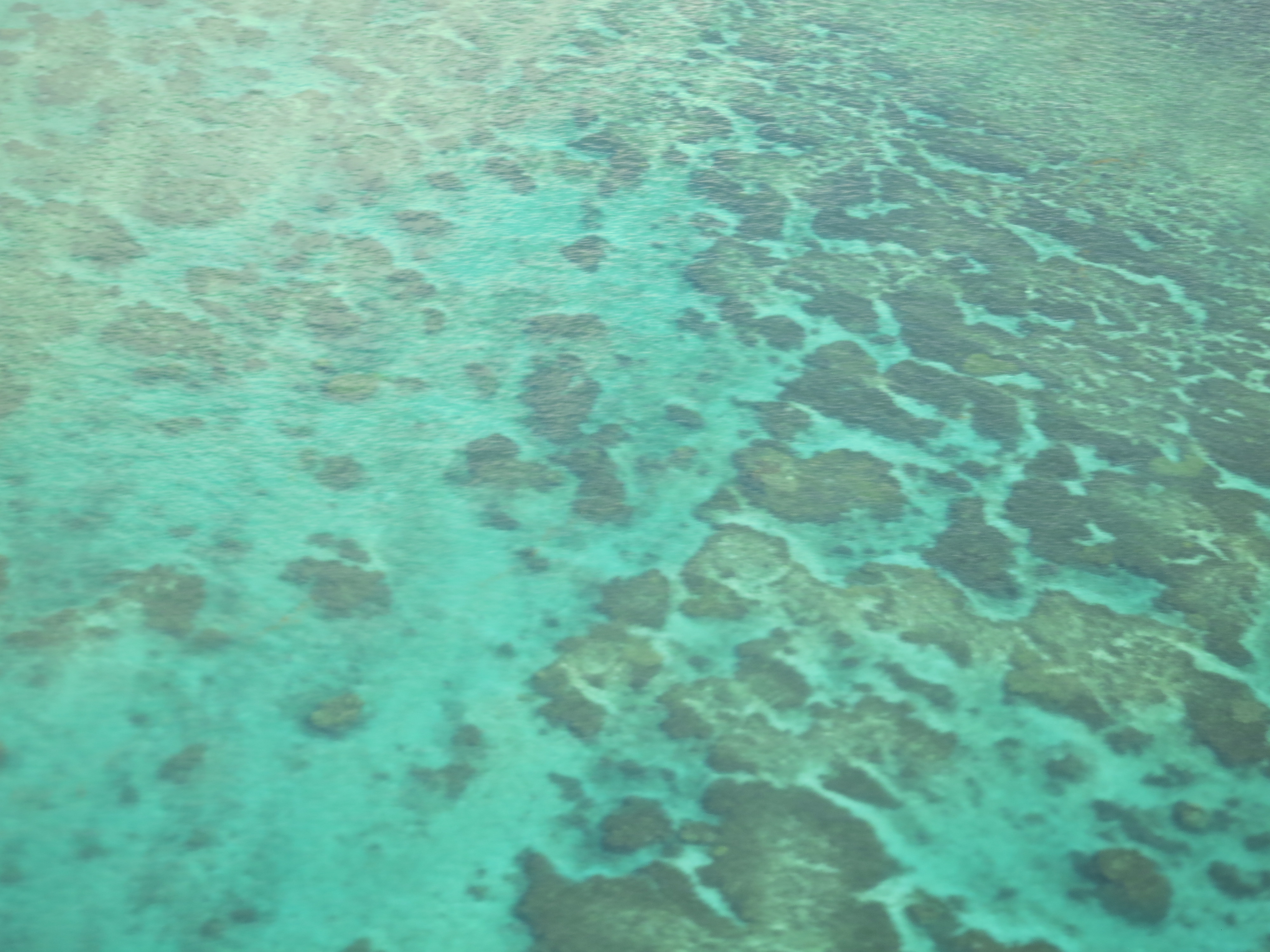
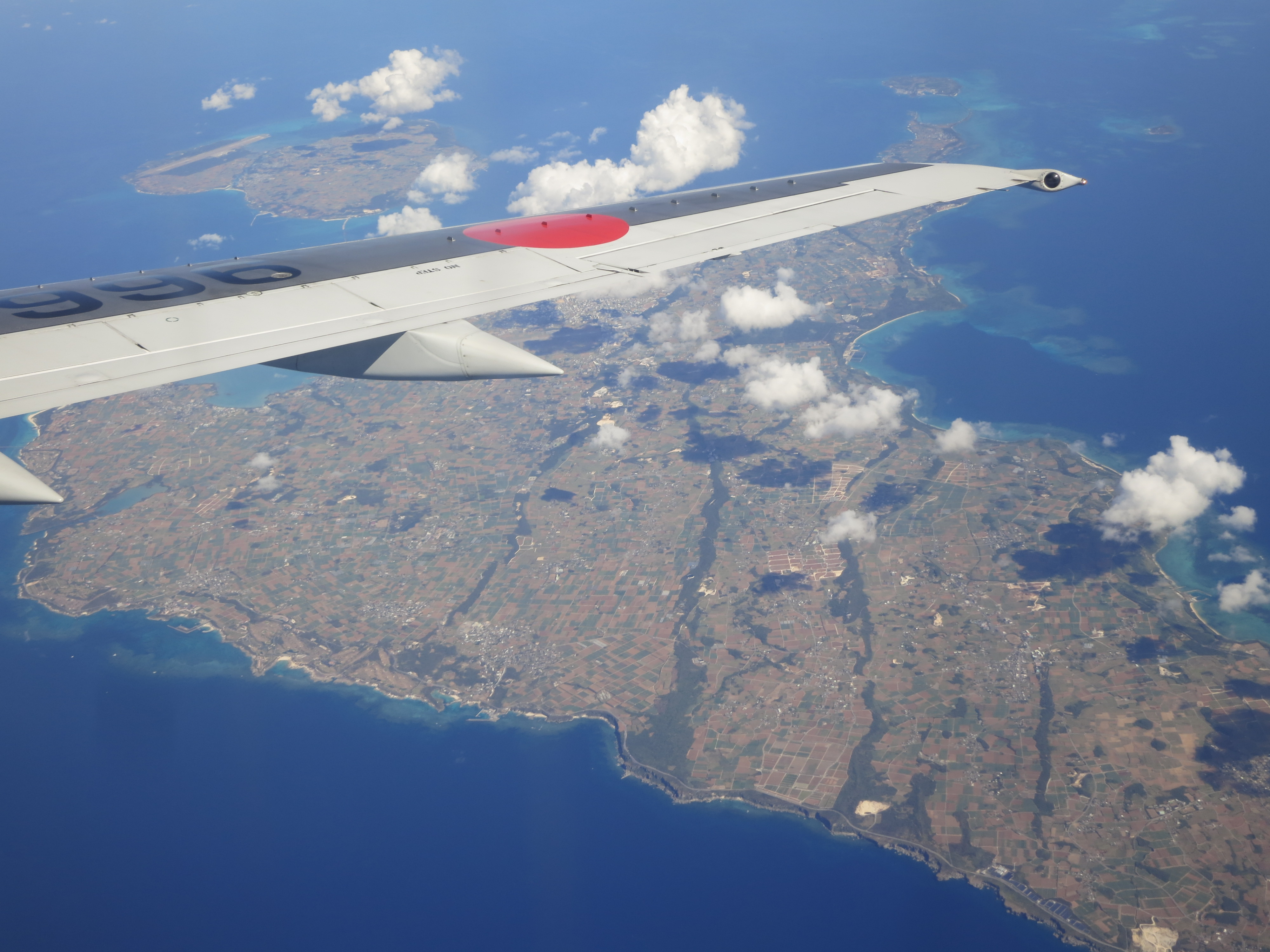
ADDED BONUS — Although I always curse myself for trying to take pictures through the window of an airplane (they never seem to turn out, after all), I did manage to have some fun with the short, jumper flights I took around the Okinawan Islands. Here are a few more shots of the island chain as seen from the air to leave you off with:


Looking forward to the Myanmar stories….I’ve been wanting to make the trip there. Was told that typically Nov through Jan is probably less humid. But then again, if you survived our humidity in Singapore, am sure Myanmar is ok!! Keep safe & Chat soon!!!
I’ve heard that late in the year is the best time to visit Myanmar, but unfortunately, I didn’t have much choice this time around. Alas, I’m arriving during the peak of Monsoon season, meaning not only is it hot and humid, but it rains all the time, too (which often washes out the roads, too). It should at least make for some interesting travel stories!
For sure!!! Travel safe! See ya soon!
The landscape of those outer islands looks somewhat similar to what I saw in Orchid Island in Taiwan. But as you said, those islands are closer to Taiwan than Japan anyway. Did you feel a strong Chinese influence in the local culture? I’m curious.
Being as close to Taiwan (and indirectly China) as it was, I was surprised to see that there wasn’t nearly as much of a Chinese influence as I would have guessed (certainly not as much as I found on the main island of Okinawa-honto — but that may just be a factor of Naha being the biggest city). Of course, this doesn’t mean that there still weren’t busloads upon busloads of Chinese tourists making their way around the islands! 😉
Enjoying your photos and comments…. Have fun in Burma, keep that camera dry. 😉 Diane Tulp
Thanks, and I’ll try (to keep the camera dry next time, that is!)
Wow, stunning photos. The food looks amazing (and everything else of course!).
Thanks!